About the exhibition
Every map tells a story. Talking Maps is a celebration of maps and what they tell us about the places they depict and the people that make and use them.
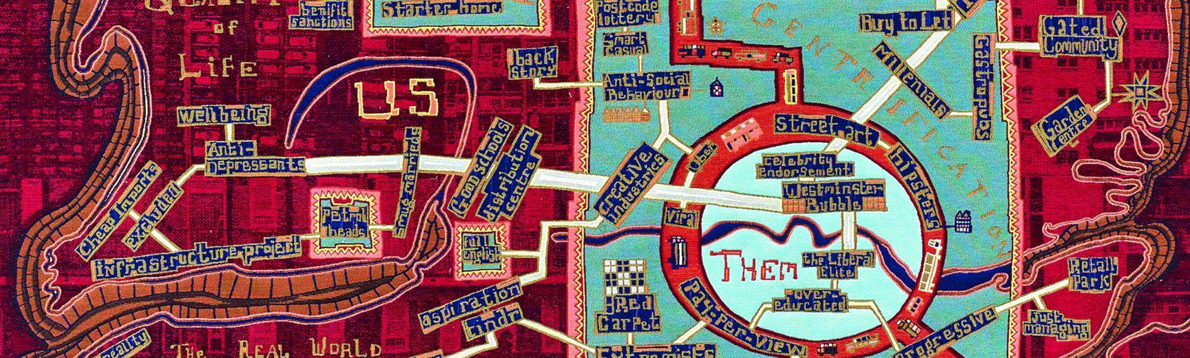
Drawing on the Bodleian's unparalleled collection of more than 1.5 million maps, this exhibition brings together an extraordinary selection of ancient, pre-modern and contemporary maps from a range of cultures and in a variety of formats as well as showcasing fascinating imaginary, fictional and war maps.
Talking Maps explores how maps are neither transparent objects of scientific communication, nor baleful tools of ideology, but proposals about the world that help people to understand who they are by describing where they are.
Highlights on show include the Gough Map, the earliest surviving map showing Great Britain in a recognisable form, the Selden Map, a late Ming map of the South China Sea, and fictional maps by CS Lewis and JRR Tolkien. Map treasures from the Libraries' collection will be shown alongside specially commissioned 3D installations and artworks, and exciting works on loan from artists and other institutions.